|
| *****SWAAG_ID***** | 790 |
| Date Entered | 24/03/2014 |
| Updated on | 05/04/2016 |
| Recorded by | Tim Laurie |
| Category | Burnt Mound |
| Record Type | Archaeology |
| Site Access | Public Access Land |
| Record Date | 24/03/2014 |
| Location | Coverdale Head. Braidley, Low Pasture. |
| Civil Parish | Carlton Highdale |
| Brit. National Grid | SE 03561 79603 |
| Altitude | 303m |
| Geology | Spring rise. Glacial drift over the Middle Limestone. |
| Record Name | Burnt mound within ancient alder woodland at spring rise in New Pasture, Braidley, Cover Head. |
| Record Description | This medium size burnt mound was recognised during the recording of a number of fine old alder coppice and pollards on the southern side of the River Cover at Braidley. The burnt mound which measures approximately 8m * 6m overall is located on a the banks of one of the many spring streams or seepages which drain the north facing slopes of New Pasture. |
| Dimensions | 8m*6m*.5m high |
| Additional Notes | Much burnt stone visible in mole hills, entirely turf covered. This burnt mound is located within an area of ancient alderwood as indeed were all burnt mounds similarly located withi alder woods at spring flushes or streams on glacial till on the Dale Sides.
The significance of alder groves to the Celtic or Druidical Religion is well known and may be a memory of the ritual use of these sweat house sites at spring rises in alder groves during the early bronze age. See Alex Loktionov 2013. The Post Hole Issue 26, pp20-33.'Something for everyone: a ritualistic interpretation of Bronze Age burnt mounds from an ethnographic perspective. http://www.theposthole.org/ |
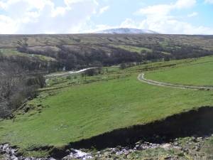
| Image 1 ID | 5264 Click image to enlarge |
| Image 1 Description | This small burnt mound is located within relict alder wood on the south side of the River Cover at Braidley. |  |
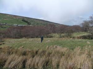
| Image 2 ID | 5263 Click image to enlarge |
| Image 2 Description | The burnt mound |  |
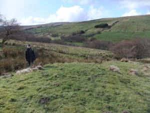
| Image 3 ID | 5261 Click image to enlarge |
| Image 3 Description | The burnt mound |  |


